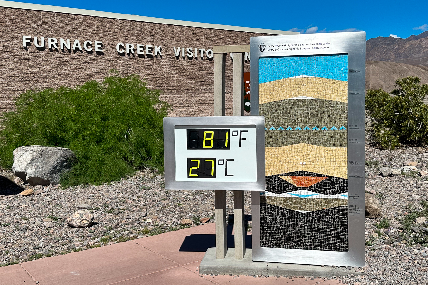
It was early afternoon on a perfect bluebird day when we rolled into Death Valley National Park. The forecasted daily high was 81 degrees Fahrenheit (27 Celsius), which is positively mild for a destination that is famous for recording the hottest temperature on earth. The timing of our visit was planned and perfect.
We often like to wing it when it comes to van travel, but not this time. We had done our homework. It seemed necessary given that we were travelling with a Nordic Mutt (Walter) to a destination proud of being the “hottest, driest and lowest”, and home to an area called Furnace Creek. We arrived prepared with a plan for where to camp, and what we wanted to see. That should be enough to ensure a smooth sightseeing experience… right? Not necessarily!
With its expansive salt flats lying well below sea level, snow-peaked mountains reaching into the sky, undulating sand dunes, and winding canyons, Death Valley is one of the most diverse and unique National Parks we’ve visited, but it’s certainly not the easiest to explore. Despite having done our homework, our adventure got off to a very rocky start. In this post, we’ll share with you what we got right, what we got wrong, and what you need to know to experience the best that Death Valley has to offer.
Death Valley Is Big… Like, Really Big!
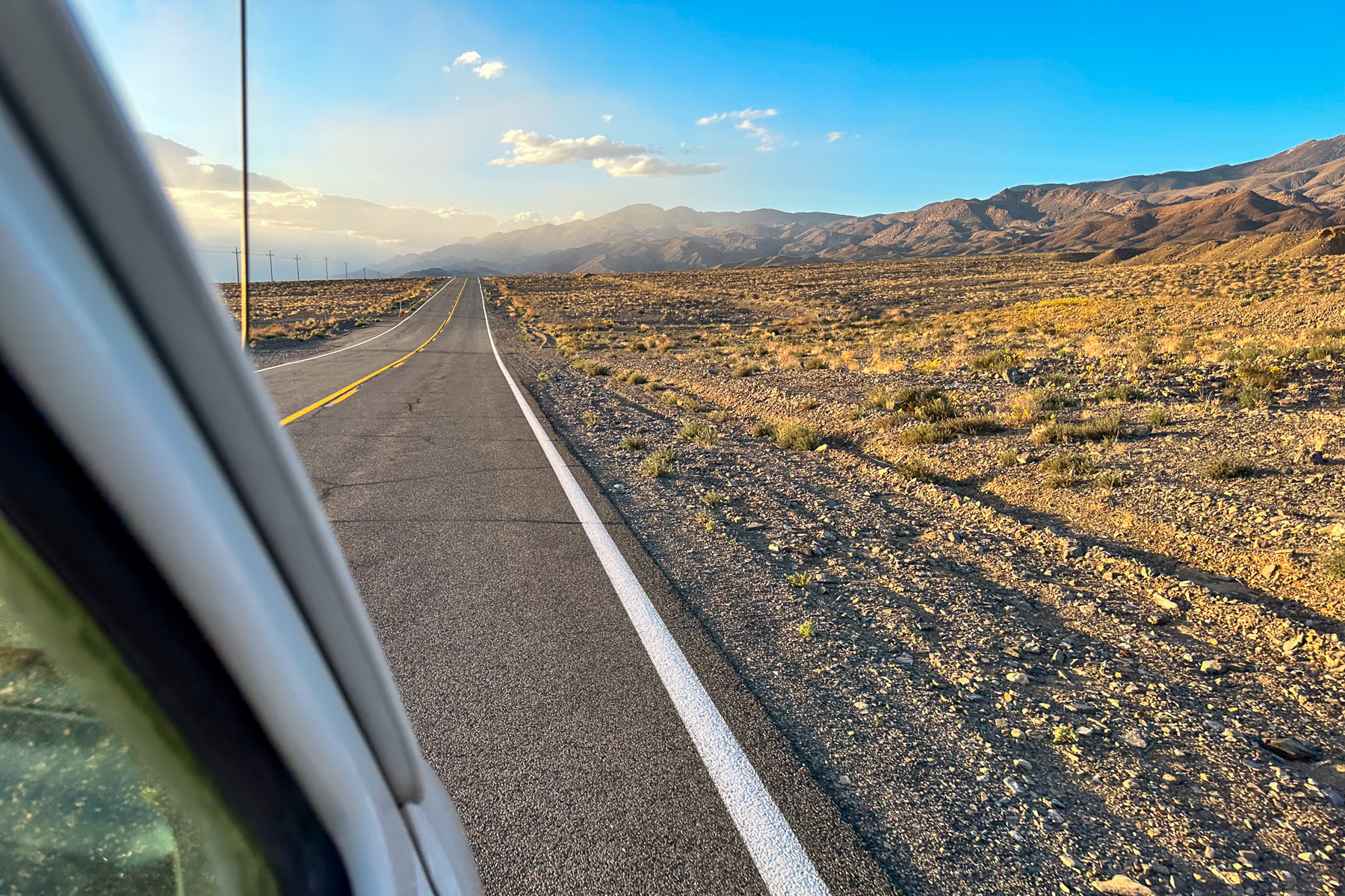
We vastly underestimated the size of the Park and the distances between points of interest. Encompassing 3.4 million acres, Death Valley is the largest National Park outside of Alaska. Somehow this fact eluded us during our research which, to be fair, was mostly watching YouTube videos 😉. Our obliviousness to the size and sprawl of the Park was the critical mistake that led to a whole domino effect of fails; a theme that repeats throughout this post.
On our first afternoon in the Park, we figured we’d pop over to Badwater Basin to explore the salt flats, cruise the Artist’s Scenic Drive, and then zip over to the Mesquite Dunes to watch the sunset. It was during an “are we there yet?” moment on our way to Badwater Basin that we finally wrapped our minds around the scale of Death Valley. Google informed us that our little pop and zip would result in an 80-mile, 1 hr 45 min round trip (make that at least 2 hours for Slow Sally) – WHAT?! Well that turned our plans upside down.
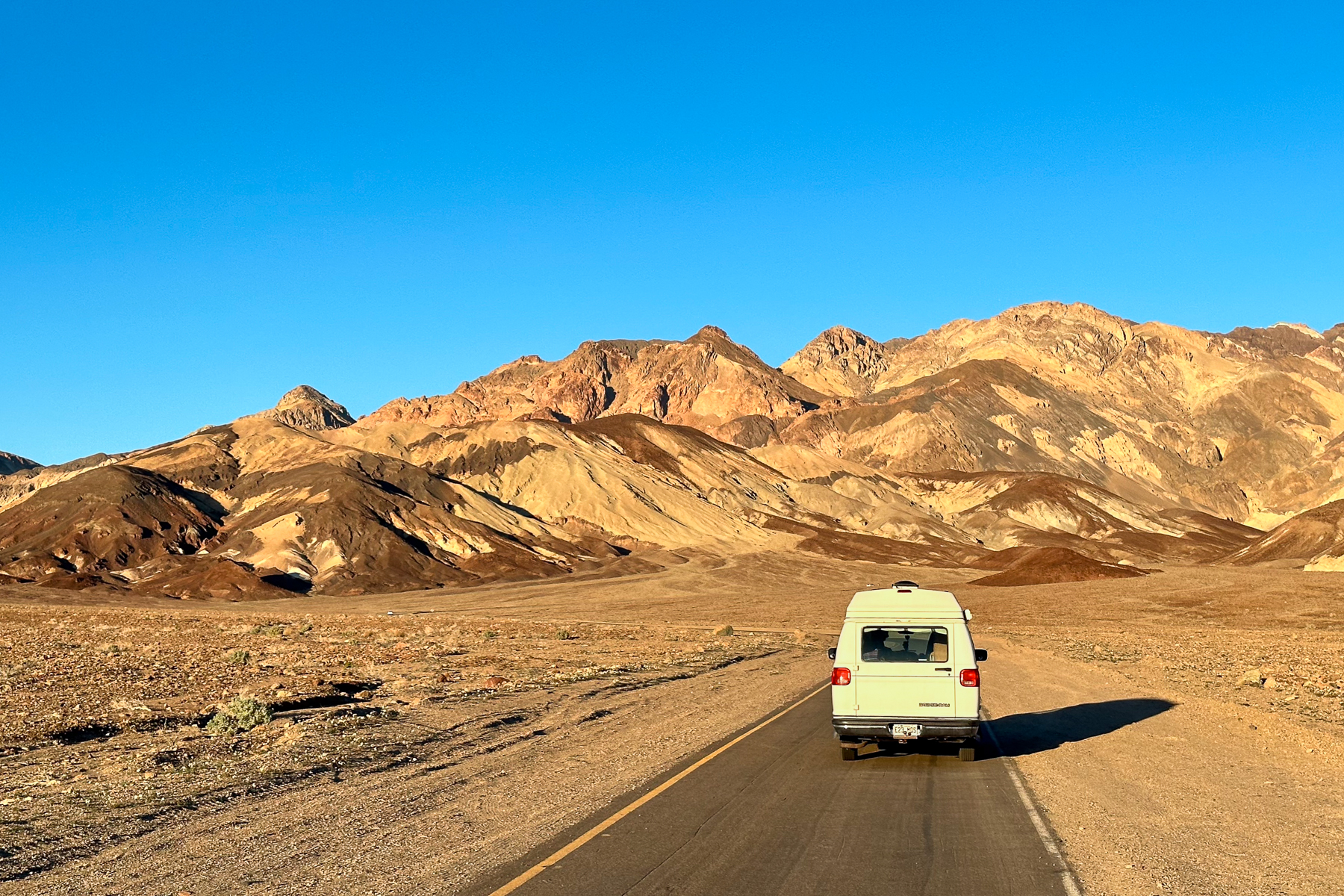
Our advice: When planning your visit, it’s really important to figure out the time and distance between points of interest. Even the most popular, centrally located sights are a long way from each other. And keep in mind that you won’t be on an interstate; the roads are narrow and winding.
Gas Is Expensive… Like, Really Expensive!
I had read on iOverlander that gas was expensive in Death Valley (i.e., I knew better!), but was unconcerned because I estimated that we had plenty of gas to get Sally to our next destination. That was, of course, before we realized how massive the distances would be to get in and out of the Park, and between sights. By our second day in Death Valley, we needed gas. Marc almost choked when we pulled up to the pump at Furnace Creek and discovered that gas was a cool $6.67 USD/gallon (that’s ~$2.41 CDN/litre for you Canadians). We filled up with just enough gas to squeak out of the Park.
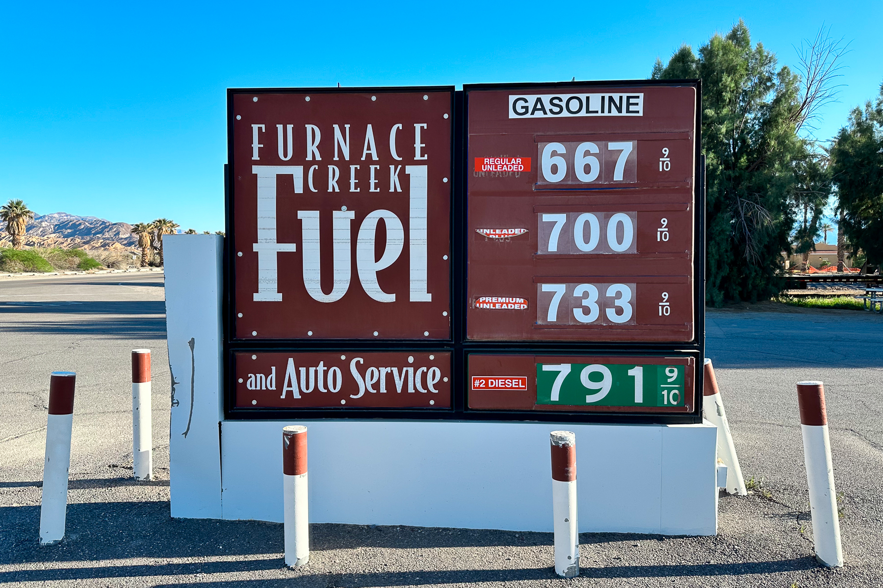
Our advice: Fill your gas tank before entering the Park. You will inevitably get enthused by the sights and drive many more miles than you expect.
Not All Campgrounds Are Created Equal
Our plan to boondock outside of the Park boundary evaporated when we realized that it would add almost an hour of driving to each of our sightseeing days, not to mention a lot of driving up and down hills in hot temperatures. Lucky for us, Death Valley offers a huge number of first-come, first served campsites throughout the Park, and they rarely fill up. Unlucky for us, by the time we figured all this out, the nicer campgrounds were full. We had to settle for the Sunset Campground – a lovely name for a spot that was most accurately described by the Park Ranger as “Walmart-style” camping.
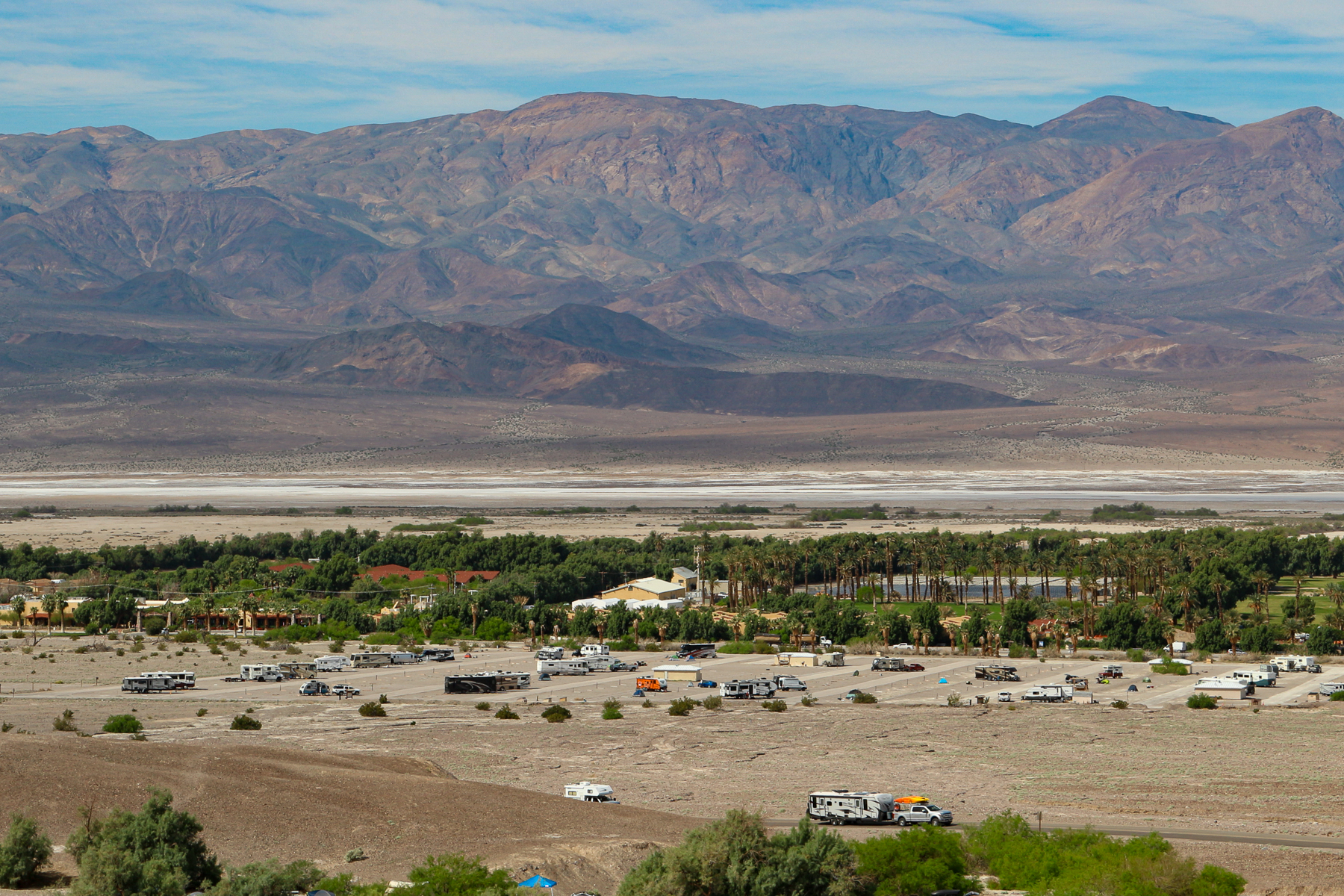
Early the next morning, we managed to nab a corner campsite in the nearby Texas Springs Campground, which is much more appealing. The campground is surrounded by gold-coloured hills, green shrubs, and has views to the snow-peaked mountains. Texas Springs was a bit crowded but with a “no generators allowed” rule, it was relatively quiet and the starry night sky was brilliant.
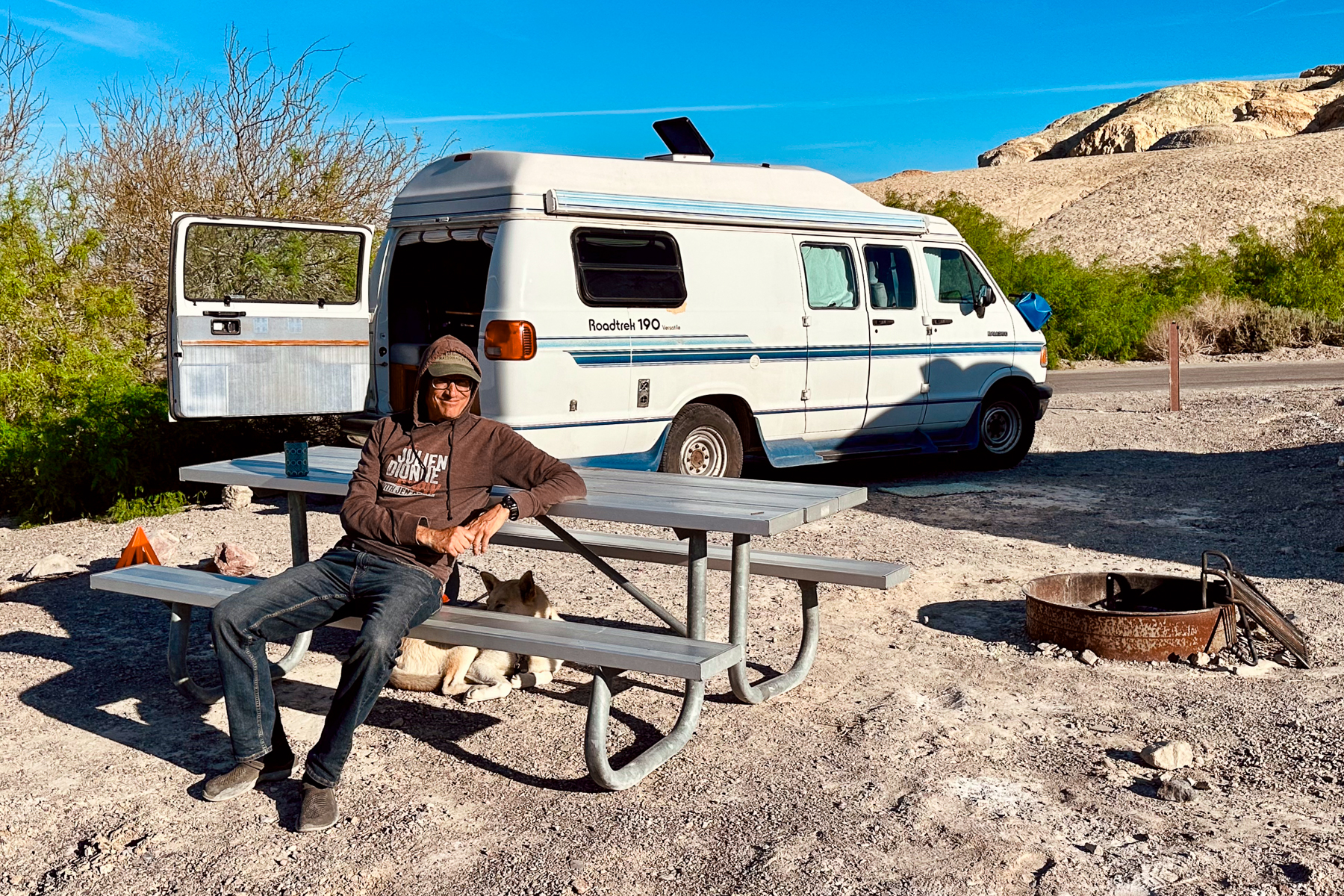
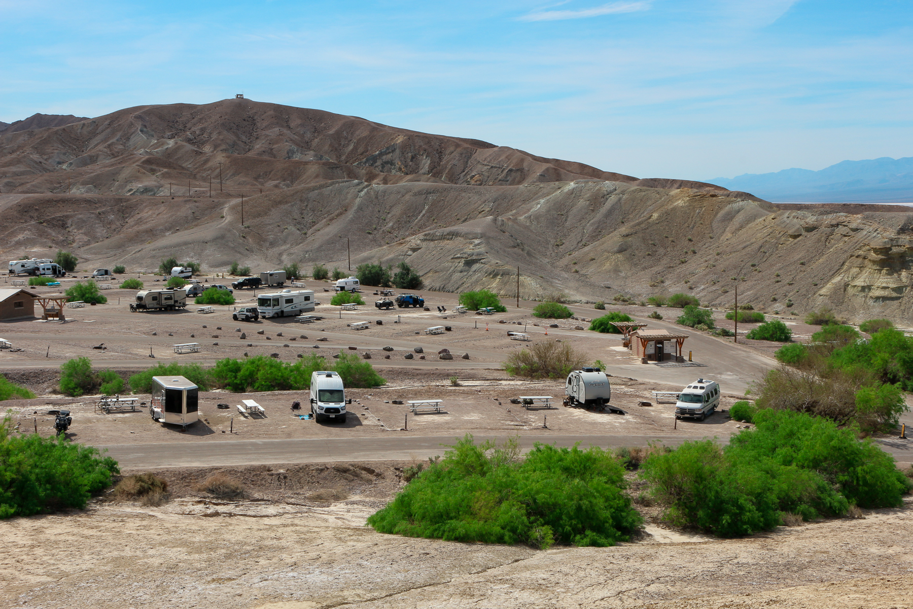
Our advice: Choose a campground close to areas of the Park you want to visit and get there early in the day (before noon). Also, avoid the Sunset Campground, unless Walmart camping is your thing.
It Gets Hot… Like, Really Hot!
As mentioned earlier in the post, Death Valley is famous for recording the highest temperature on earth. We chose to visit in late March knowing that the temperatures would still be tolerable for hiking, sightseeing, hanging around the campsite with Walter, and spending time in a van without air conditioning. In summer, the daily high temperatures average 105 – 115 degrees Fahrenheit (well over 40 degrees Celsius).
Our advice (and everyone else’s): Keep the climate in mind when timing your trip, choosing which parts of the Park to visit (some areas are at much higher elevation, and therefore cooler), and deciding whether to bring your pet.
Dogs Aren’t Allowed On Trails, But…
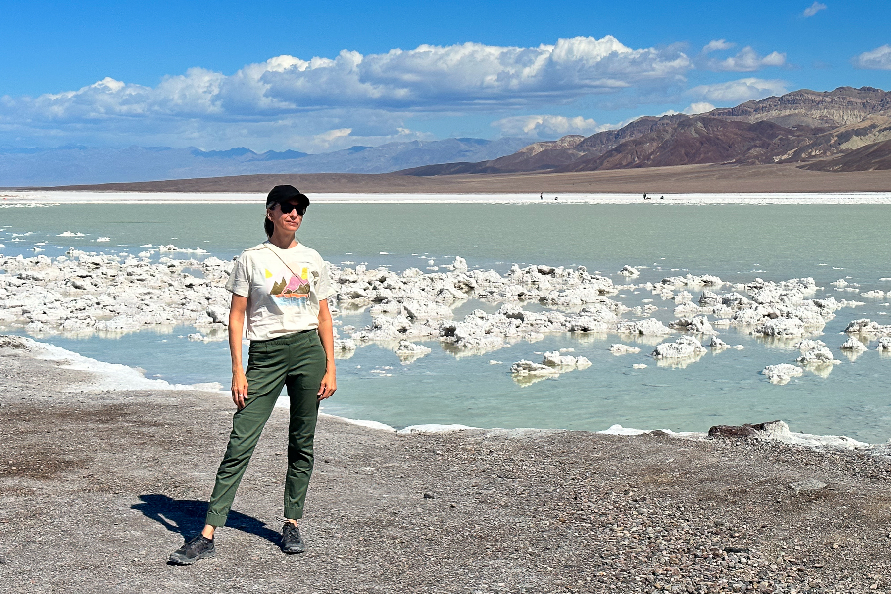
None of the trails in Death Valley are dog-friendly; dogs are only allowed on roads and in developed campsites. This is a common restriction in US National Parks and the main reason we don’t spend more time in them. However, a helpful Park Ranger informed us of an awesome loophole: hiking with dogs on closed roads is permitted. When we visited in March, several roads were closed due to flooding and winter damage, creating all sorts of dog-friendly hiking opportunities. We walked with Walter on the closed Devil’s Golf Course road, which wound through the salt flats and offered some of the best views of the surrounding mountains. All three of us were thrilled.
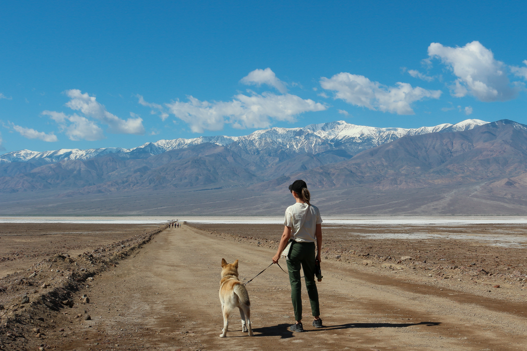

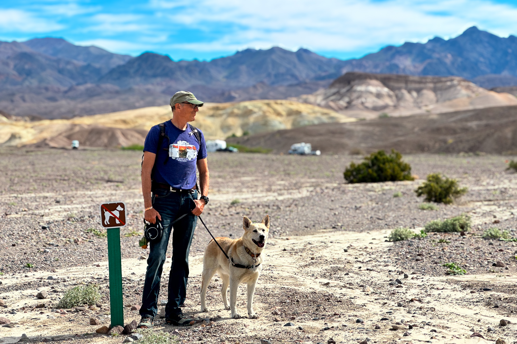
Our advice: If you’re travelling with a dog, ask a Ranger about closed roads; there might just be some new temporary hiking trails to enjoy with your four-legged friend.
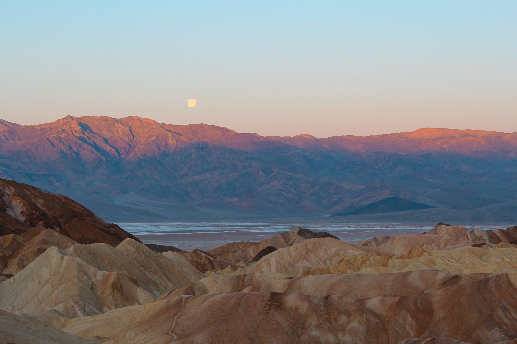
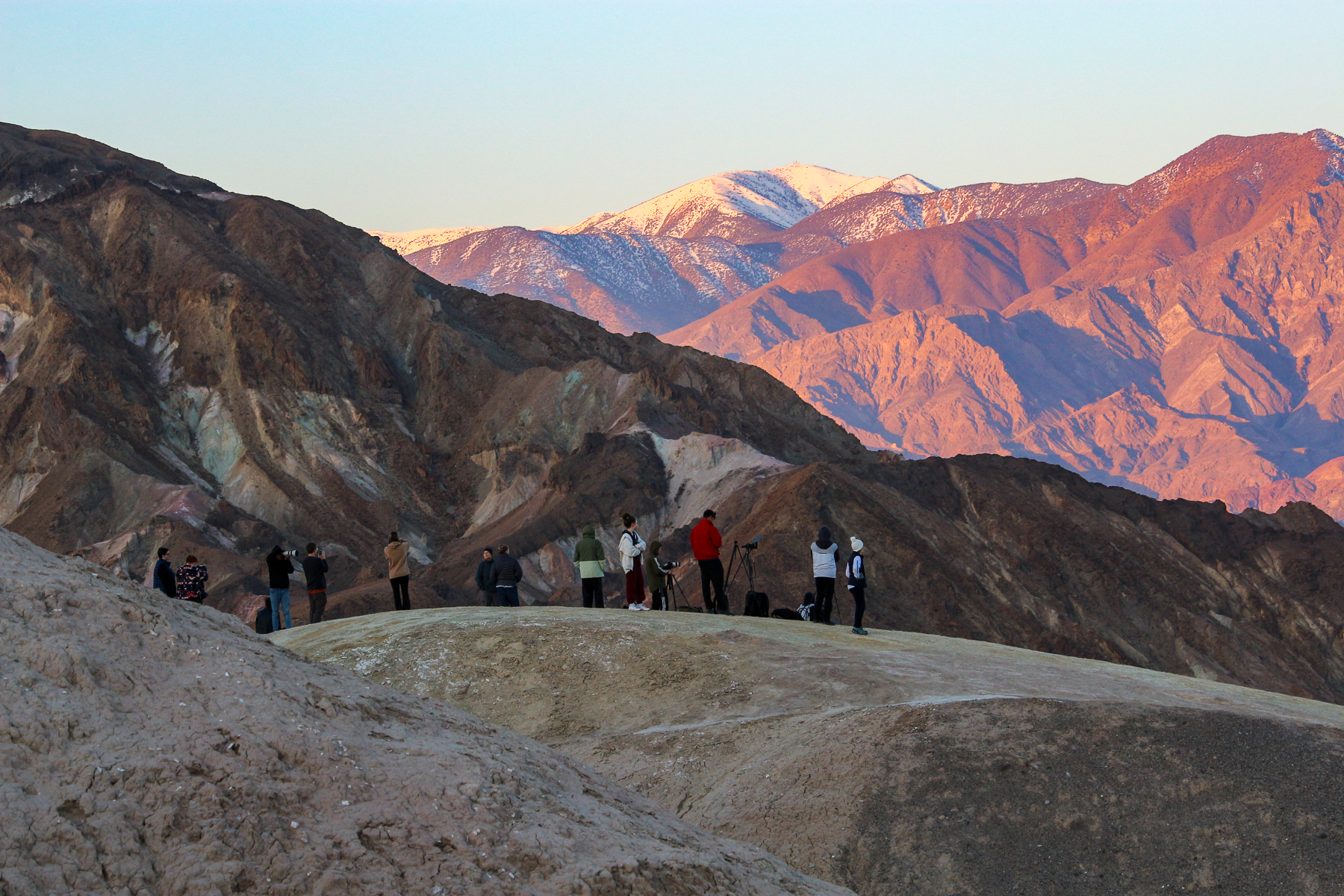
Timing Is Everything
Once we wrapped our minds around the times and distances between points of interest, we made an art of being in the right place at the right time to experience the best of what Death Valley has to offer.
We managed to drag ourselves out of bed in the dark to watch the sunrise at Zabriskie Point. Although getting up at that early hour was painful (we’re not early birds), it was absolutely worth it to witness the moon set and watch the sun rise, lighting up the salt flats, turning the hills a glowing gold, and the mountains a warm pink-ish purple.

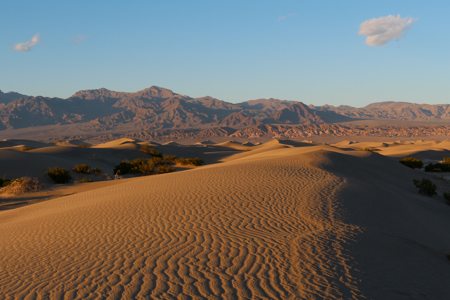
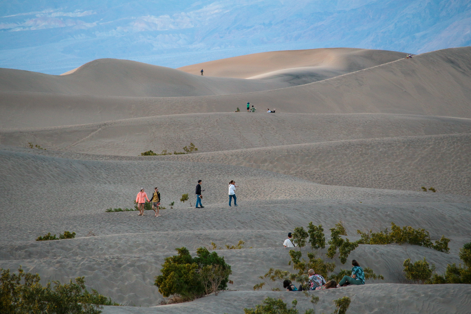
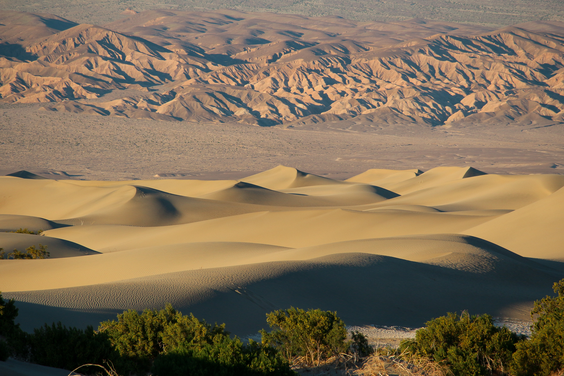
Later in the day, we hurriedly filled Sally’s gas tank before racing off to admire the Mesquite Dunes at sunset. The colours of the dunes transformed from light beige to deep browns and golds before our eyes, with the purple shadows emphasizing each ripple in the sand.
Some landmarks, like the Artist’s Scenic Drive and Mosaic Canyon, are spectacular at any time of day… well, as long as it’s daylight. One of the many fails on our first day included arriving to admire the colourful rocks of the Artist’s Palette just as it turned dark. Our visit to that sight took 2 takes.

Our advice: If time allows, follow the advice in the Park’s pamphlet for the best time of day to visit Death Valley’s most beautiful natural features.
Points of Interest Are… Interesting!
Many of Death Valley’s natural features are more than just scenic viewpoints. They are landscapes that can be entered and thoroughly explored.
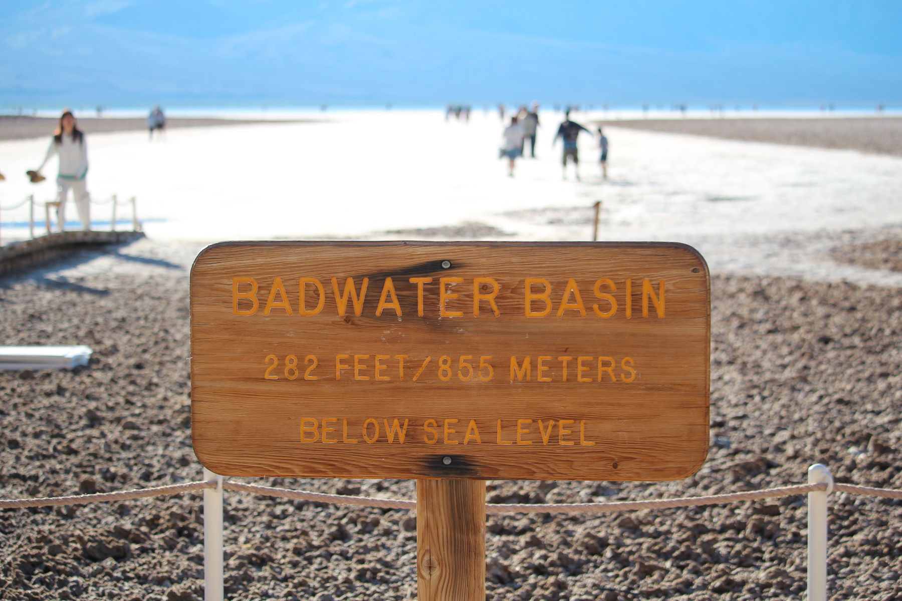
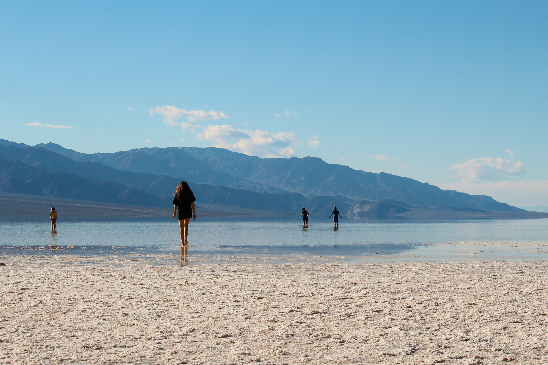
At the Badwater Basin, we ventured far out onto the salt flats to witness the record breaking flooding (usually the flats are dry), kneeling down to feel the salt between our fingers, wading into the water, and of course, taking lots of photos. At the Artist’s Palette, we weaved our way up and through the colourful rock formations, admiring the textures and colours up close. Getting the best views of the Mesquite Dunes at sunset required taking off our shoes and scurrying up the tall, soft dunes.
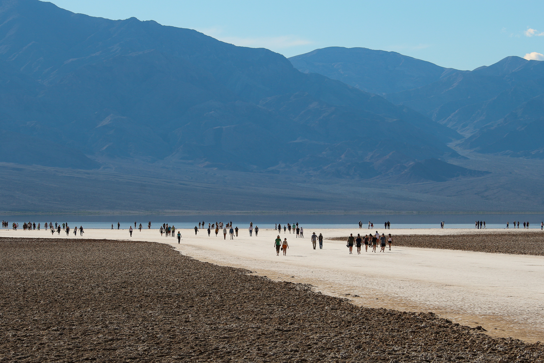
Fully experiencing each of these sites required immersing ourselves in the environment, not just hopping out of the van for a quick photo. In our opinion, the Park pamphlet greatly overestimates how much you can do and see in a half-day or day.
Our advice: If you want to immerse yourself in the landscapes, set aside a minimum of 30 minutes for each point of interest. If you’re travelling with a dog like us and need to take turns exploring, double that amount of time.
Stay Tuned
Death Valley was as impressive as we expected… perhaps even more so. But after a few days of intense sun, crowded parking lots, and far too many dog-related restrictions, we were ready for an adventure in the much higher, much cooler, much freer, wild west. But more about that in the next post.

Love your helpful post, thank you! Death Valley has been on our bucket list for a while.
LikeLiked by 1 person
Thanks Ray! Death Valley is definitely worth keeping on your bucket list. One of the things that impressed us most was the Park’s diversity. The Panamint area is a part of the park I’d like to explore if we ever go back. We drove through it on the way out and it had a beautiful valley full of desert gold wildflowers and was surrounded by mountains.
LikeLiked by 1 person
Great information. Thanks…..we have been there and it is amazing, but we were there a little too late for camping. Way too hot! We ended up getting a room for the night. I will use your blog for our next trip and check out Texas Springs for camping in our van.
LikeLike
So glad that you found the post helpful. Yes – it’s crazy how hot it can get there! There are some camping areas at higher elevation that are cooler – but they’re further away from a lot of the main sights… so not super convenient. Good luck and enjoy seeing it for a second time with your van!
LikeLike
98D170P, aka Old Blue. Headed out from New Hampshire just after new years to the Southwest and into CA – still working on my wife in terms of Mexico 🙂 – Your blog is so helpful to us, as we travel with a large pup as well.
Last spring we were in Montana, Idaho and Oregon – the hiking and scenery was incredible!
We spend a lot of time in state and national forests, which as you guys probably know, are often located right outside of national parks and typically do allow dogs! Plus, they are usually much less crowded!!
Thanks again for all the info guys! Hope to meet up with you guys on the road sometime!
Mike, Meredith and Baxter
LikeLiked by 1 person
Hey Old Blue Crew 🙂 Great to hear from you. Yes – we love the National Forests, BLM land, etc… they are the perfect places for us too. One of the challenges of the California Coast was that there wasn’t much of that type of camping available. We had to get creative!
We actually drove through Montana, Idaho and Oregon on our way back from the west coast. Fantastic states! We were in a bit of a rush – I’d like to spend more time in that area exploring. Idaho was such a pleasant surprise for us – so much more than just potatoes, lol.
It would be great to meet up on the road some day. And if you guys get the chance, I highly recommend dipping down into Mexico!
LikeLike